[I changed T Emplacement for Unit J6 }
I changed #### and ##### to ###
Back to top: Ordered aggregation
Ordered aggregation
When components such as stones or bricks are organised along a horizontal and a vertical axis, we can speak of an ordered aggregation of elements that concern construction, i.e. a wall, a drain, an oven. A pit, or the foundation pit too, concerns the intentionally man-made process of excavation and construction.
Here you will find the most important features ordered by type, with the main characteristics that define the structure. A complete list of cuts and walls can be found in the synoptic table. A detailed description of each feature can be found under its respective number.
Back to top: Ordered aggregation
Cuts
Four pits were documented in J6, directly east of the staircase flank wall. The fills are described in amorhous.
A small round pit f92 was excavated in the brickfall f92. The pit was filled with soil f87.
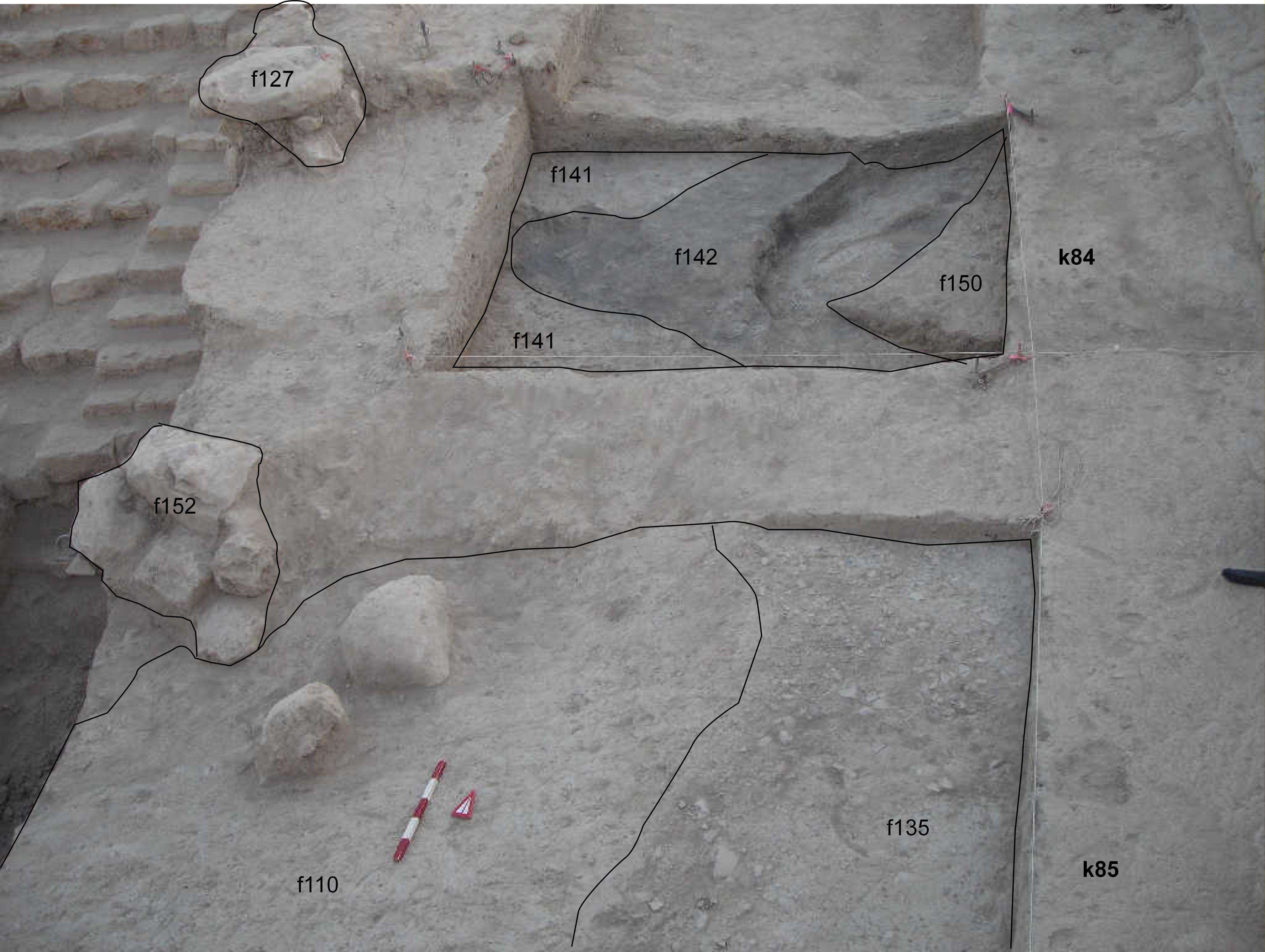
Another pit f122 cut into f151 and was filled with f142. The remaining portion of this pit was excavated as J4f136.
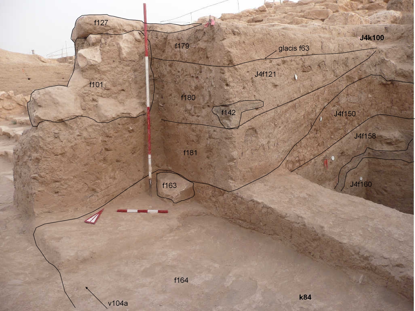
The hollow pit f199 cut into dump f200, glacis f192 and removed the upper stones of wall f227. It was filled with ashy soil f192.
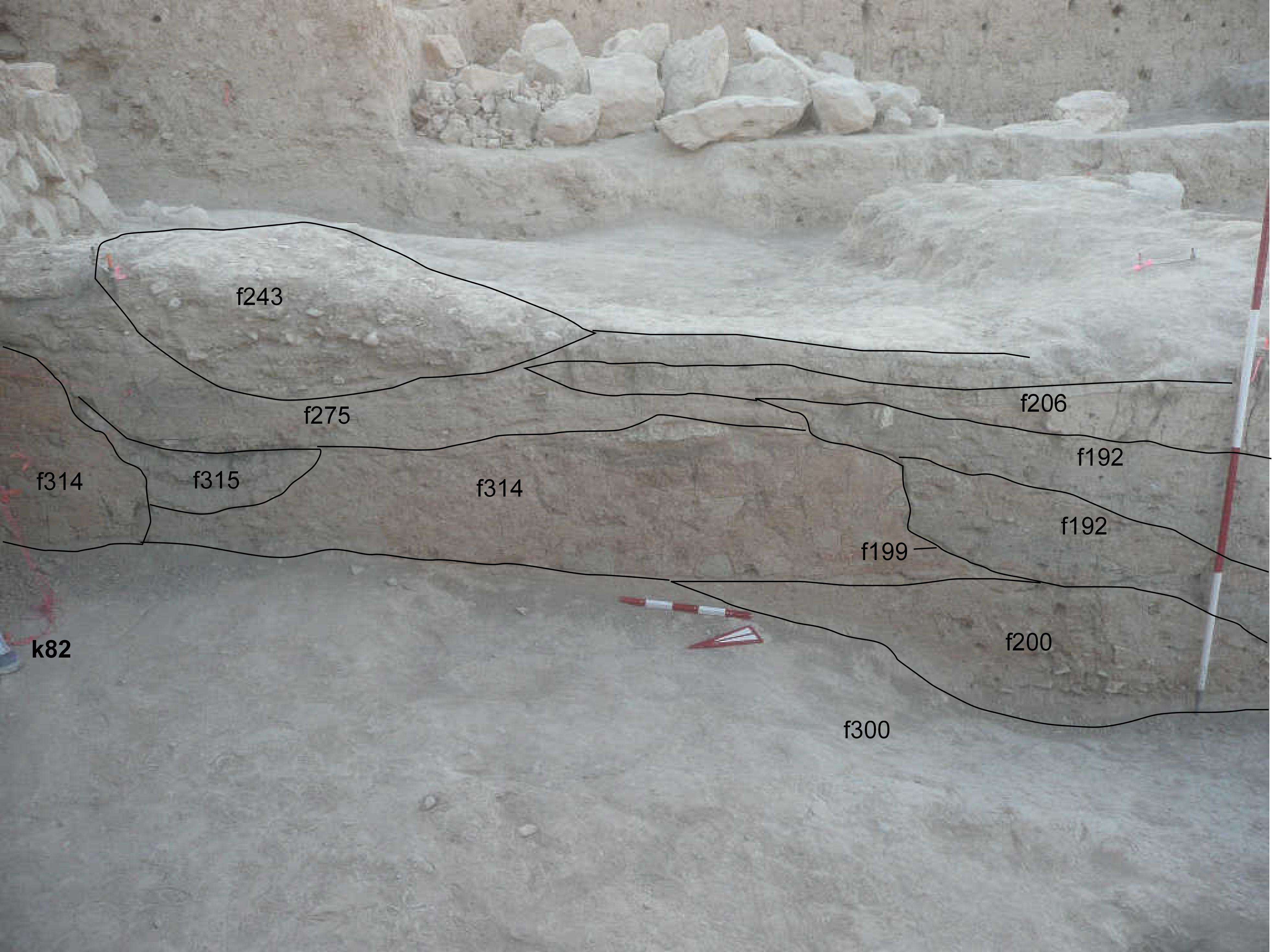
A further pit is f283, filled with f282. It cuts pit f192 and glacis f275.
A cut attributable to water erosion was identified in the northern part of J6, directly in front of wall f218. This natural process removed a part of glacis f275. The resulting hollow was filled with a lens f243 of pebbles mixed with soil.
Back to top: Ordered aggregation
Mudbrick walls
We found six mudbrick walls in J6. Two of these walls belong to bin a7. The others are only partial remains of larger structures. These are incomplete due to the excavation work being interrupted.
| feature | description | dimensions | image | wall1 | Small portion of a mudbrick wall consisting of two visible rows of bricks. The wall was found under brickfall bf2 and was cut by pit f92. | elevation: 9104m | 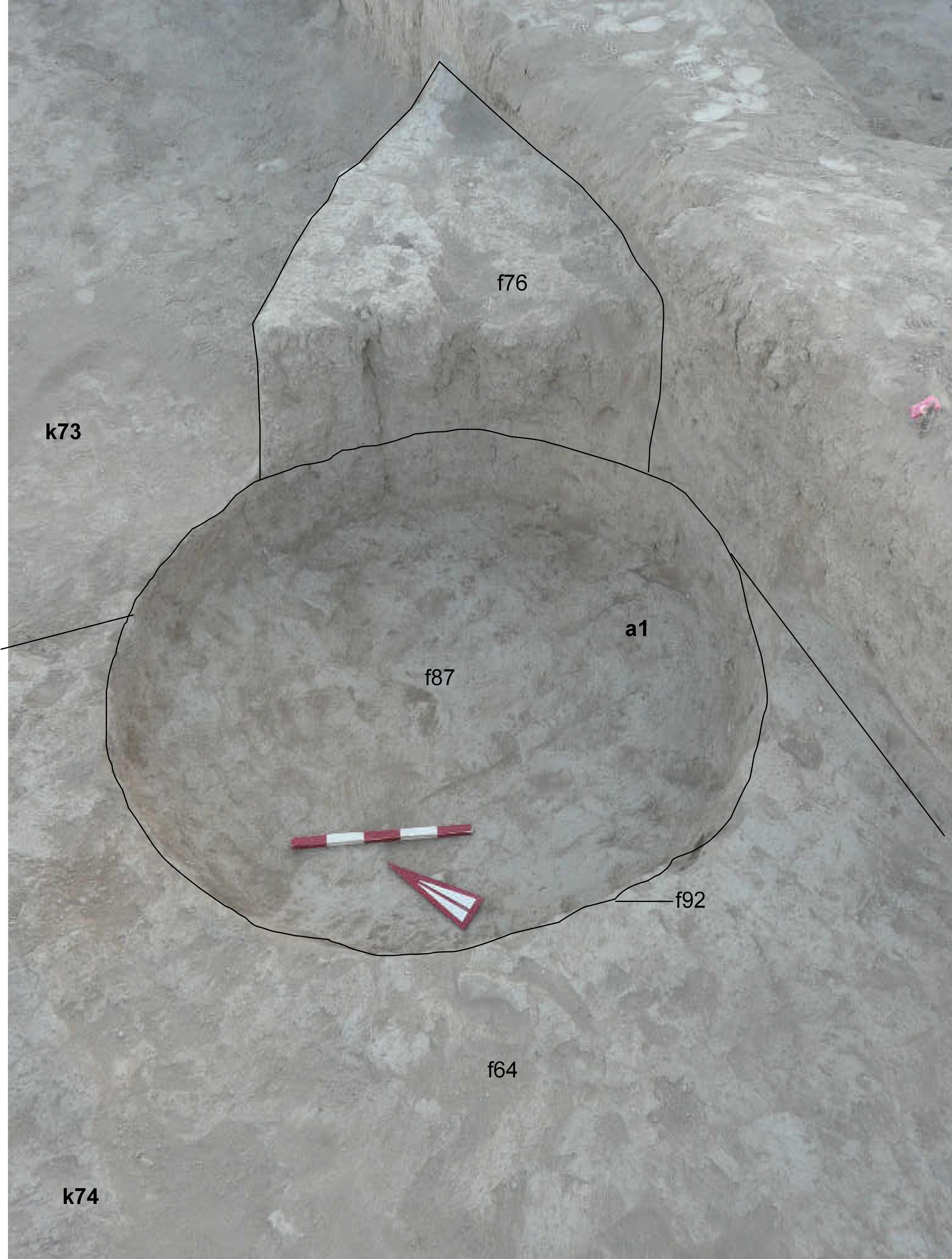 |
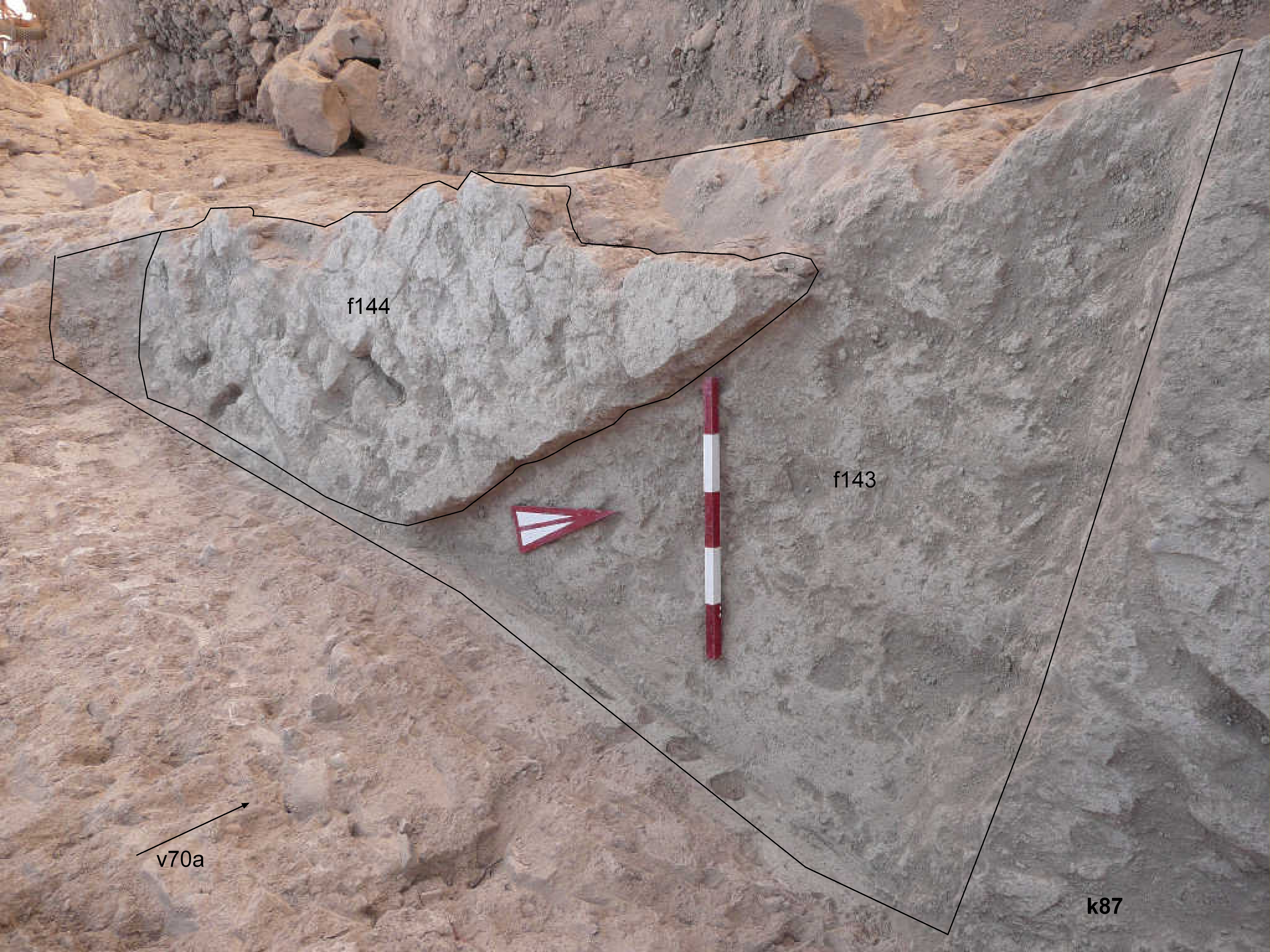
f144 | A small portion of a wall with NNW-SSE orientation at the extreme southern end of unit J6, covered by brickfall bf2. The wall is cut by the trench k200. It follows the orientation of the structures found in Area C (cfr. M 915 in A76 C7a, Bianchi et al. 2014, Beilage 2). | 1m wide, 1m long, elevation: 8986m |
 |
| wall7 | A portion of a wall with NW-SE orientation, covered by glacis1. | 2.5m long elevation: 9020m |
 |
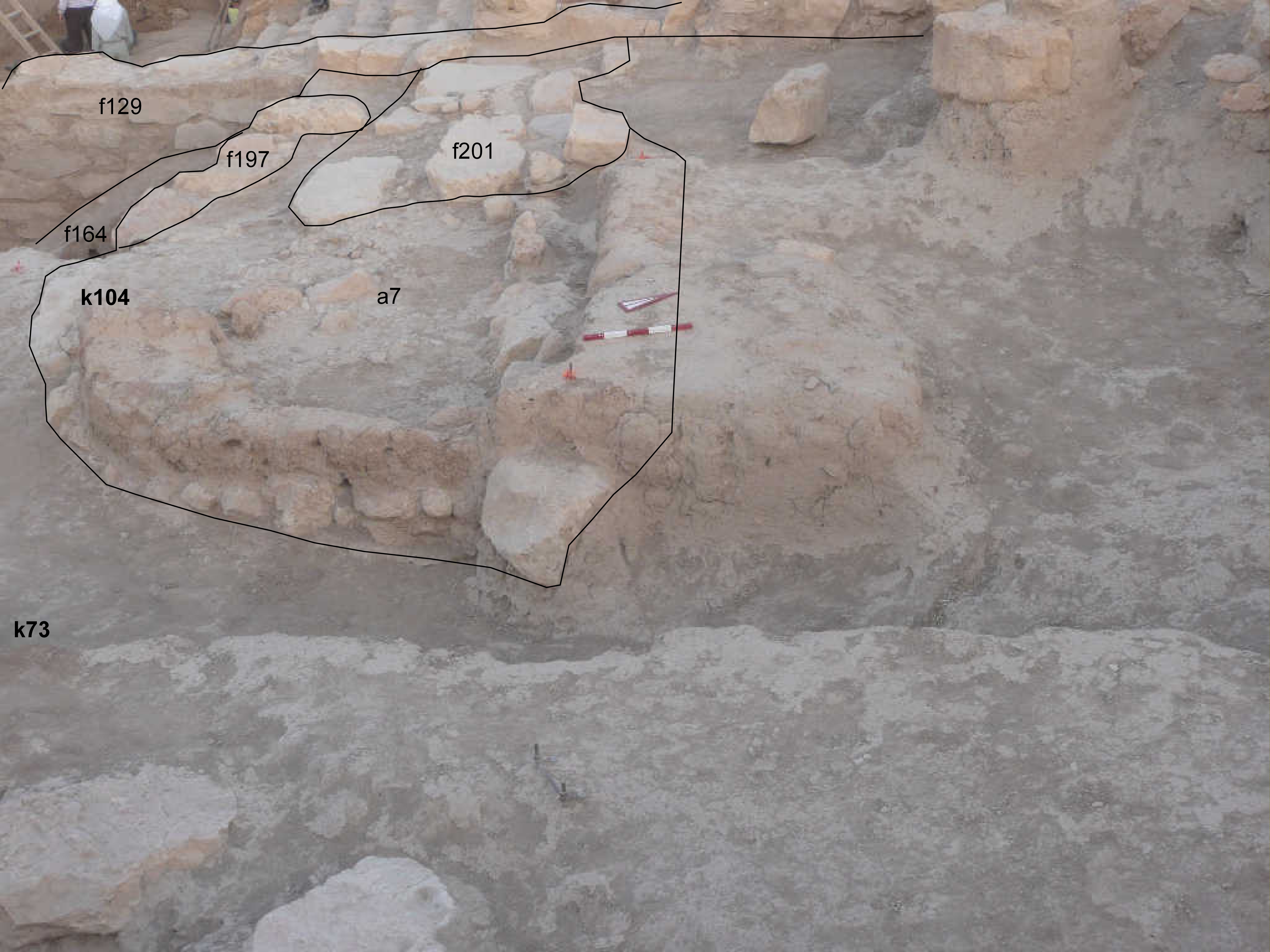
| f233 | A mudbrick wall with E-W orientation. The mudbricks are set on top of stones wall10. Northern wall of bin a7. | 40cm high, 2.70m long, 1.20m wide, elevation:9140m |
 |
| f234 | Wall with a half moon plan. The mudbricks are set on top of stones f197. Eastern and southern wall of bin a7. | 20-30cm high, 20-50cm wide, elevation:9100m. |
 |
| wall13 | A mudbrick wall under wall6 and wall12. Red mudbricks with grey mortar. | 70cm high, 40cm wide elevation: 9155m |
 |
Back to top: Ordered aggregation
Stone walls
We exposed 16 stone walls of various dimensions and construction techniques. Two of them are located in Area C2 and were excavated by the German team in Year 2001. We cleaned these walls and assigned them J6 feature numbers. These are f24, f27.
Here are the stone walls excavated in J6:
| feature | description | dimensions | image |
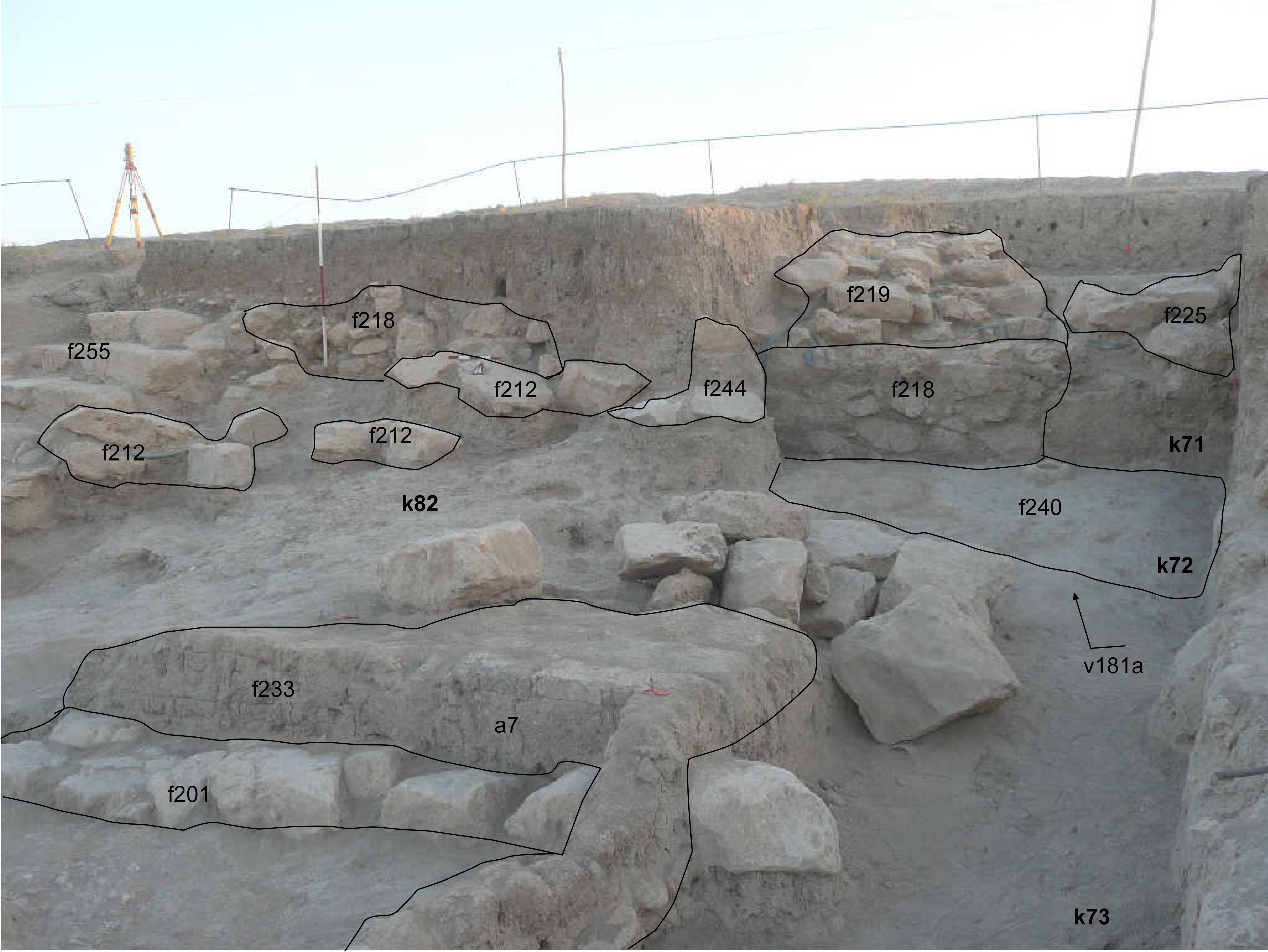
| wall10 | 7 medium and large limestones are set in a line with an ESE-NWN orientation, set on top of accumulation f203. The wall is used as base for mudbrick wall f233 of the bin a7. | 6m long, 1m wide, one stone high elevation: 9104m |
|
| f197 | The wall is crescent-shaped when viewed in plan and is the substructure for mudbrick wall f234 of the bin a7 | 4m long, 20-100cm wide elevation: 9033m | 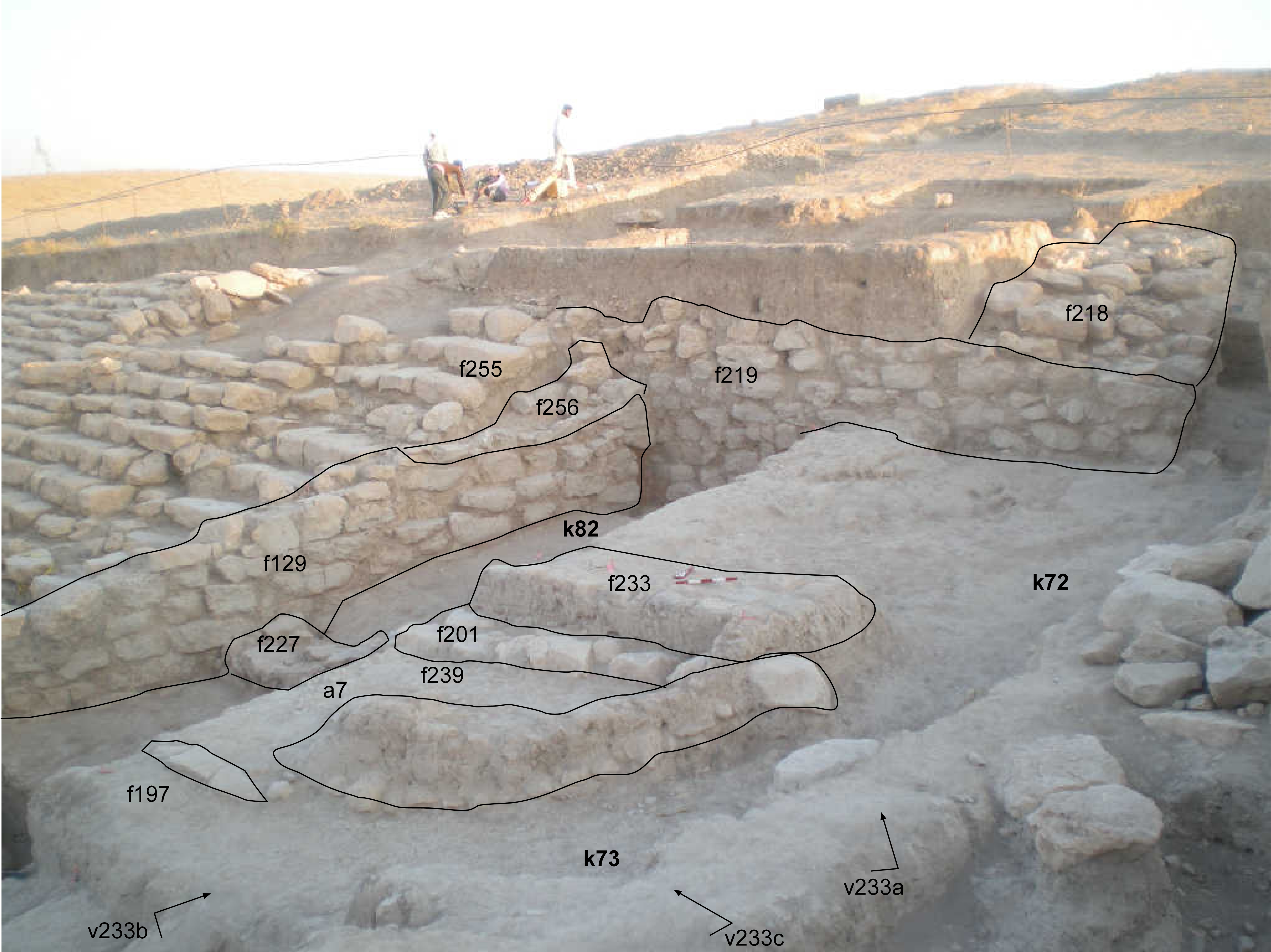 |
| wall2 | A line of 7 small and medium size limestones with NNW-SSE orientation, located in the eastern portion of J6 in k64 | 3m long, 50-80cm wide elevation: 9071m | 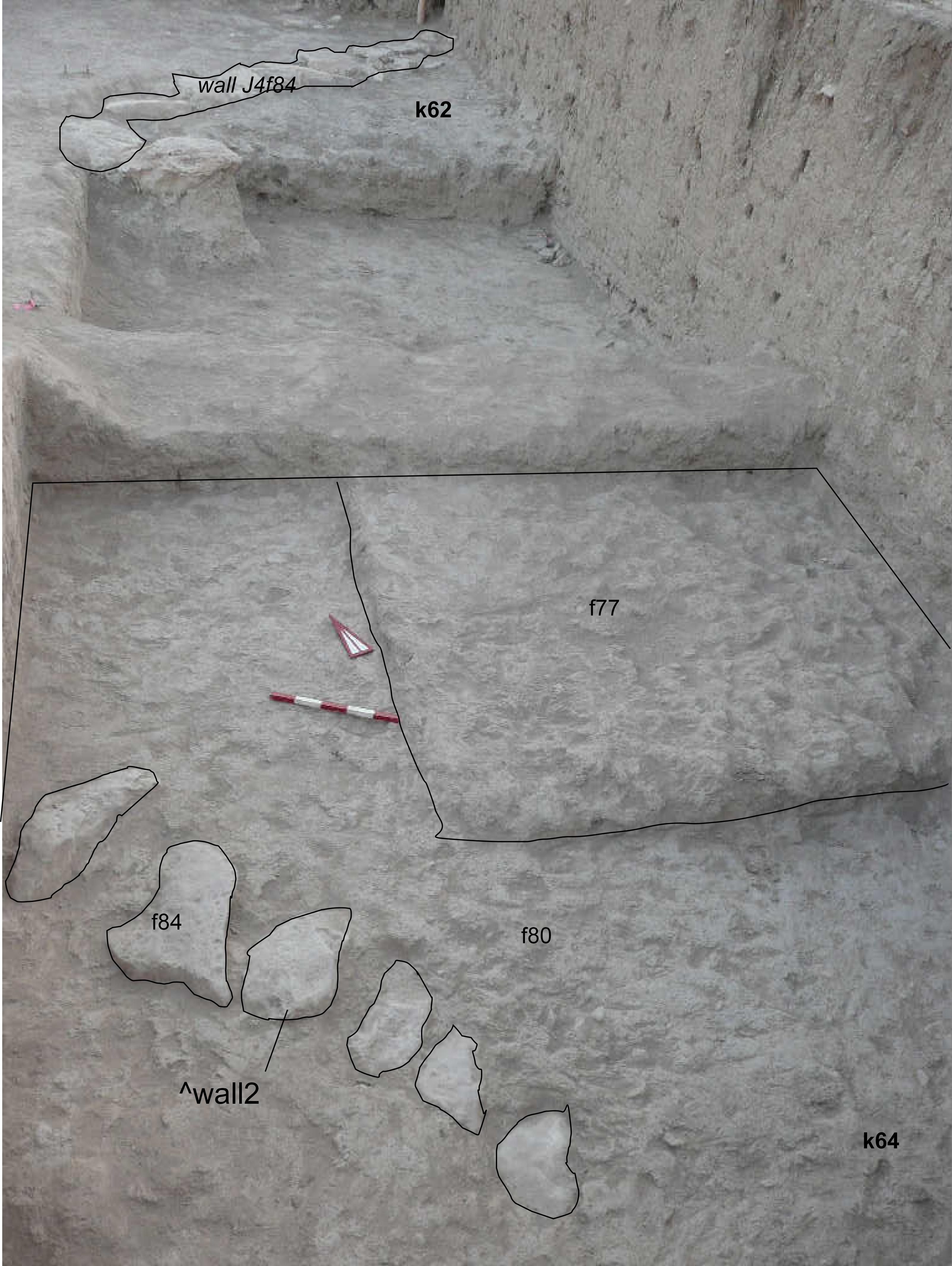 |
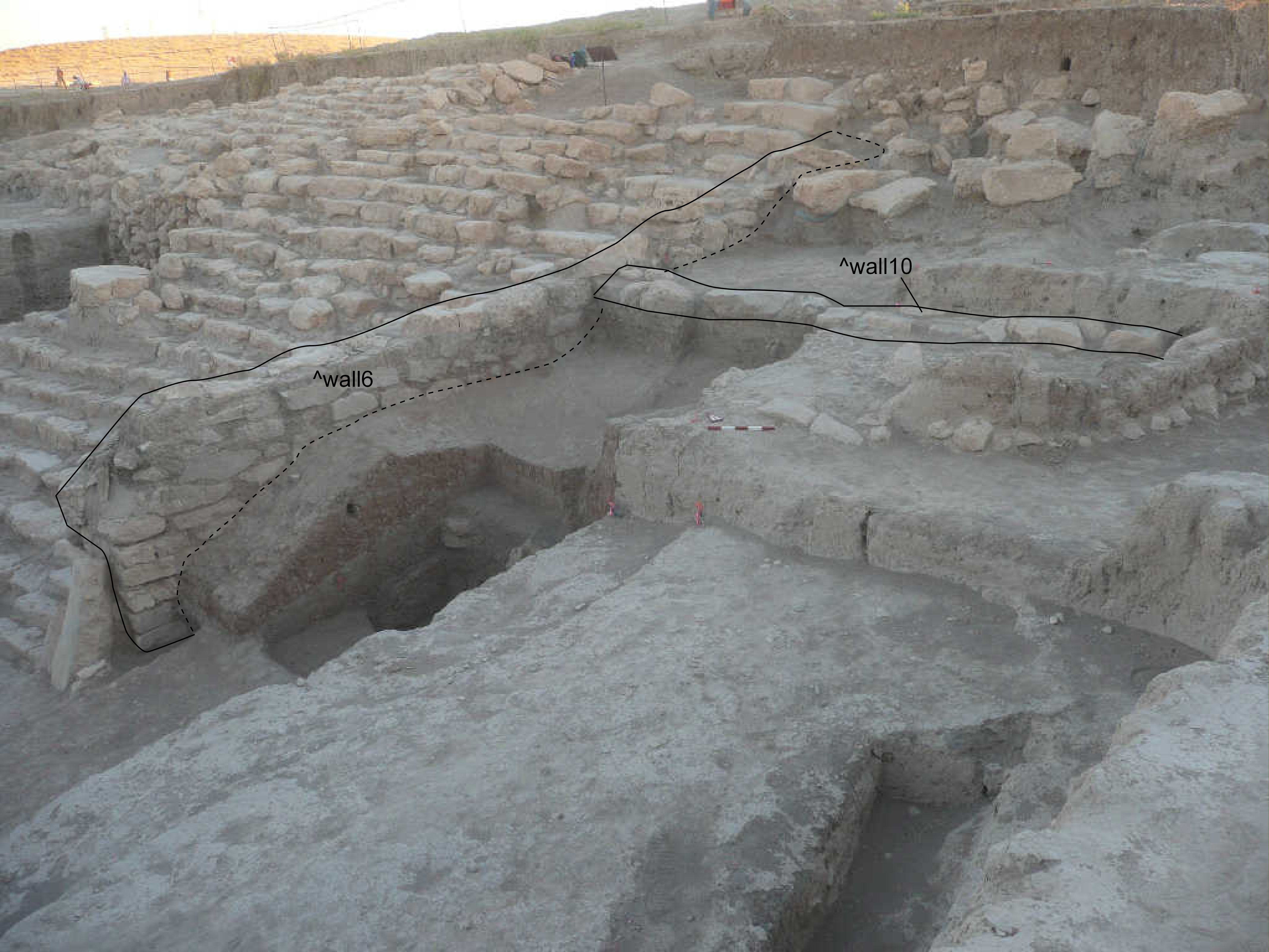
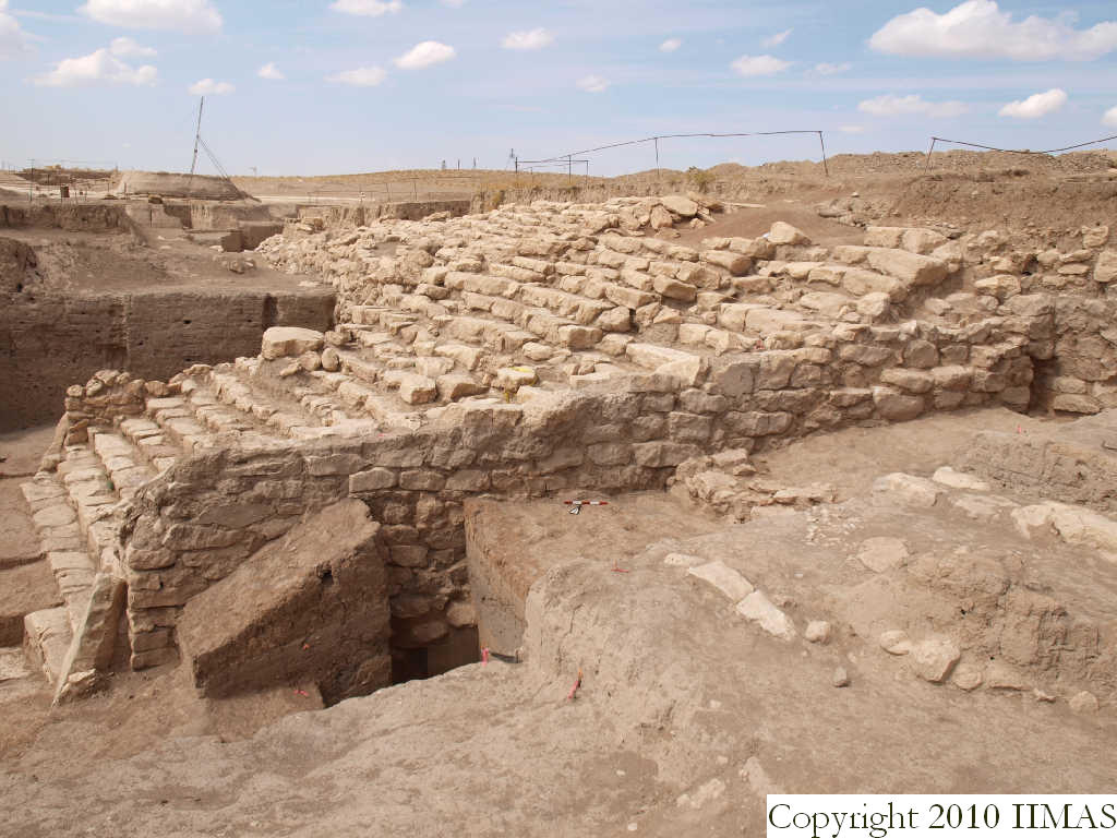
| wall6 | Eastern flank staircase wall with a NNE-SSW orientation. It starts at the southern side with two stones set in oblique fashion (Betili f100, f177, and stone f186) and ends abutting wall f218. The top is covered by wall5. | 12.67m long, 1.20-1.58m wide, 2.85m high elevation: top 9058m, bottom 8800m |
 |
| wall5 | Wall with NNE-SSW orientation laid on top of the first southern 7m of wall wall6. It rests on top of a 20-60cm thick layer of mud mortar. | 7m long, 1,10m wide elevation: top 9150m | 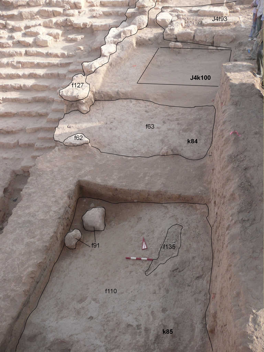 |
| wall4 | wall with NW-SE orientation. It consists of 5 medium sized rough stones laid in mud mortar. Two stones are located 50cm to the east, probably collapsed stones.(cfr. T267+T401 Phase C 6a Inst. 994 (Bianchi et al. 2014, 109), J2f144. The wall rests on top of glacis2 = ? C 6a Inst. 710 or C2-Inst.872), which covered the 11th step of the staircase) [to be added in JP - ZK320 pC]. | 2m long, 1m wide elevation 8937m. |
 |
| wall3 | wall consisting of 13 medium and large stones, some of them are rough other are rougly dressed, set under wall5 and directly in front of wall6. The soil between the stones is f170. Abutting the wall was found floor f157. | 2×1.70m, 4-5 stones high. elevation: top 9056m, bottom 8950m |
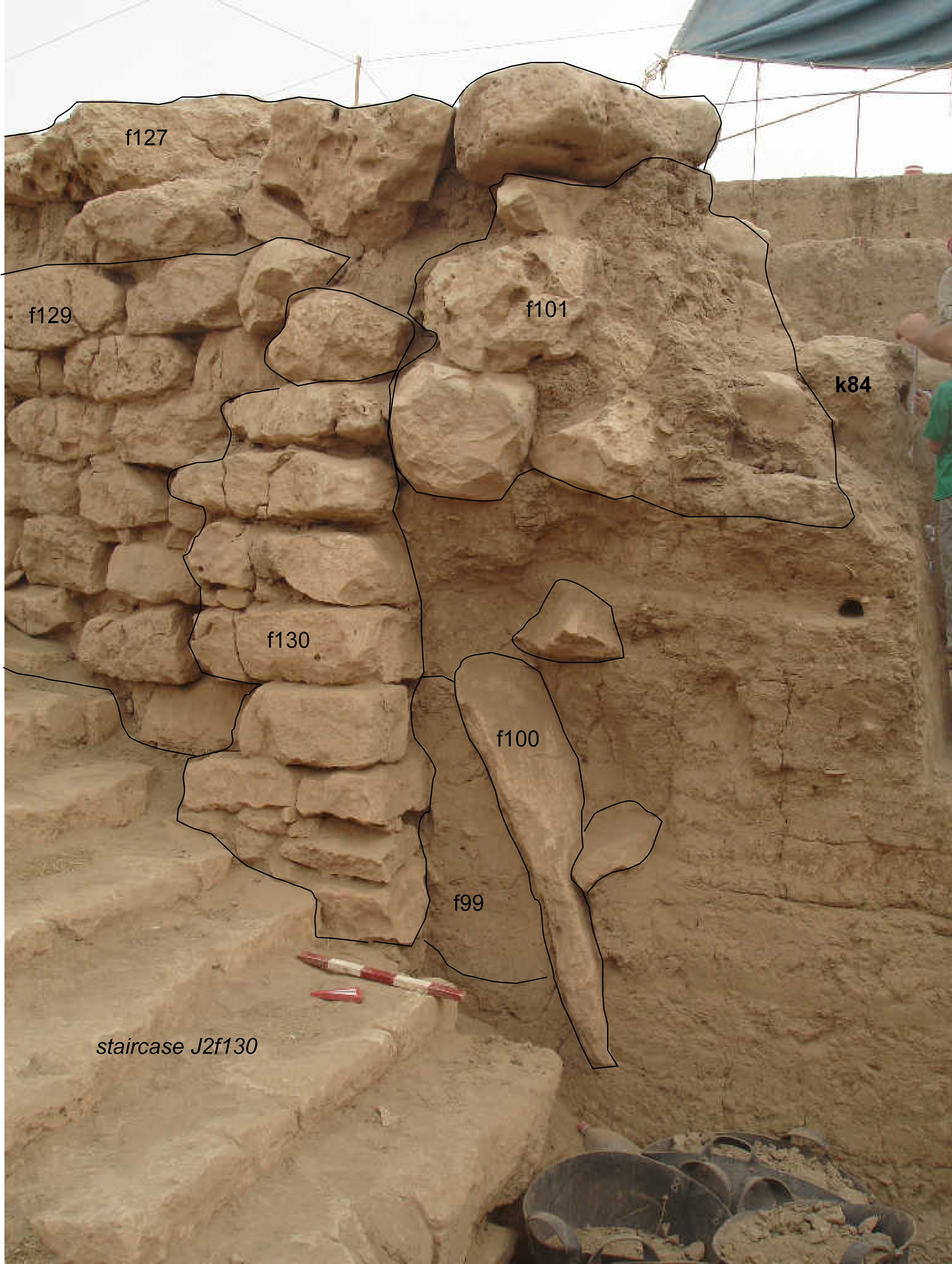 |
| wall12 | Revetment or retaining wall, starting directly north of the staircase. The three western lowenmost courses are stepped resting on top of a mudbrick wall wall13. The lowermost course is abutted by glacis7. | E-W 8.10m and NS 6.60m long, 3.25m high |  |
| wall11 | A stone wall set parallel to wall12 abutting or cut by wall wall6, Angular and irregular stones are set in regular courses. The upper stones were removed by pit f199. | 3.20m long, 90cm wide, 40cm high. elevation 9020m |
 |
| wall15 | Two medium sized stones set in a regular line, embedded in f297, abutting wall wall6 and set parallel to wall wall11. Other stones were found at the same elevation and same position in unit J4 k100. | 85cm long, 45cm wide, elevation: 8897m |  |
Back to top: Ordered aggregation
Glacis
We have recorded a series of deliberately placed layers beginning to the east of the staircase flank wall wall6 and dipping to the south-east, ending aproximately where the stone betili are located. These layers different in color, consistency and inclusions, are characterised by a sharp lower and upper boundary, are between 50 and 10cm thick in section, and become thinner to the south due to the sharp inclination of the lower underlying layers. The upper layers are sloping sligtly, whereas the lowes ones have a sharp inclination. We have named these layers “glacis”, especially because of their function in relation to the staircase flank wall.
These layers, beginning from the upper one, are:
|
glacis 1 (see especially f63) is a very well defined compact, hard grey surface, it slopes towards southeast and wall5 and wall4 are buit on top of it. The glacis is covered by the brickfall and covers glacis 2. glacis 2 is under glacis 1 with similar charachteristics of the first one. The surface was sloping toward south-east, was hard compact, very well defined with plenty of small pebbles and white calcite inclusions. In section was 10 to 60cm thick (f180) and brown-gray in color with some mudbricks. glacis 5 is located under glacis 2, covering glacis 3. During excavation was labeled f151, a hard dark and wet brown soil with charcoal and patches of ash and some pottery. In this layer we found a group of frit beads i15. In the western section was recorded with f181 and here is 10-20cm up to 60cm thick. glacis 3 (see especially f164) is a thick band (50cm to 2m) of granular soil, with a characteristich red-orange brown coloration, due to the presence of natural virgin soil (baqaya) and a lot of mud bricks and some pottery sherds. Its surface is well defined and has a sharp inclination toward south-east. The upper portion was removed by pit f199. This is the first of the series of glacis abutting wall11. glacis 6 is located under glacis 3, abuts wall11. It slopes sharply toward south and has a clear surface, compact and grey in coloration, when excavated was grayish brown, ashy and fine in texture. The upper and lower boundary were well defined in section. Wall wall5 was embedded in this glacis. |
 |
We recorded following layers south of wall12:
|
glacis 8 is the first upper glacis exposed south of wall wall12, abutting its lowest courses. It is a compact red-brownish earth with complete mudbricks, calcite inclusions and small sized pebbles (f314) and about 50-60cm thick. The layer slopes to the south and overlays dump 2 (f200) and covers glacis 7 (f300). glacis 7 is a hard and compact layer with small pebbles and few sherds lying flat in surface (see f300). It abuts to the south wall wall11 and was found under glacis 8 and dump2 (f200). This glacis was exposed but not excavated. |
 |
Back to top: Ordered aggregation